Gunung Nuang

Highlights
Height : 1, 493 m (the highest mountain in Selangor)
Location : Hulu Langat, Selangor
Time Budget to the peak : 8 - 9 Hours
Entrance Fee : RM 1.00
Hard-O-Meter : 3-Star
View-O-Meter : 1-Star
The Not-to-Miss : Waterfalls, sunrise at the peak
Height : 1, 493 m (the highest mountain in Selangor)
Location : Hulu Langat, Selangor
Time Budget to the peak : 8 - 9 Hours
Entrance Fee : RM 1.00
Hard-O-Meter : 3-Star
View-O-Meter : 1-Star
The Not-to-Miss : Waterfalls, sunrise at the peak
The Trail
1. Entrance/Parking
2. The never ending road
3. Pipeline
4. Dam
5. Kem Lolo
6. Hut camp
7. Red Clay Trail
8. Kem Pacat
9. Puncak Pengasih
10. Gunung Nuang Summit
Memory Lane (23-24 February 08, Organized by RIKL)
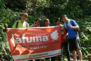
There were 17 of us in a group that day who gone up Gunung Nuang and that was no easy task. All of us were carrying at least a 60 Litres rucksacks filled with tents, group kit, cooking equipment, food and personal stuff for 2-day-1-night camp.
The first part was pretty rocky, uphill and it seemed never ending. We went through the pine tree forest and bamboo gardens, and the birds were singing the whole morning. That could be your only i-Pod in the jungle. After lunch at Kem Lolo, we gave our steps the final push through the red clay up to Kem Pacat, a campsite before the peak.
The team decided to camp there and make it to the summit for sun rise the next morning. Before the dark falls, our efficient chefs made us nice rice with mix fried vege dressed with Sambal Ikan, some get the Rendang Ayam! Our dinner was served on flysheets, a lantern in the middle and music from one of my friends' i-Pod. A great dinner with chats and laughter.
It was really, really cold at night. We went to sleep and woke up at 4 in the morning to catch the sun rise. Hiking up in dark was much easier than what I imagined, because you could hardly see anything except the glaring torches of the group. We were so excited when we reached Puncak Pengasih, still that's not the peak yet! Felt cheated for a while, duh...
"Are we there yet?"
"We are just 5 minutes away. C'mon guys!"
This Q&A was repeated for about 6 times before we reach the peak. Finally, everyone had a mad yell when we were at the summit. There was this signboard saying "You are the best!". The sun rise we saw on that morning worth the sweat.
Came back down to Kem Pacat for our breakfast before we leave. Decamp was quick, and all the rubbish was brought down as we are all nature lovers. I discovered more about the team and myself in this trip and hopefully there will be more improvement in the next trip up.

Getting There
By Car
From Kuala Lumpur, travel south to Cheras. Take the Cheras Highway heading to Kajang. Exit the toll. When you see a signboard stated "Air Terjun Sg. Gabai" on your left, take an immediate left turn. Go straight along the road until you reach traffic lights, you will notice a police station on your right. Turn left and follow the direction of Pekan Batu 18. Keep going until you enter a place with some TNB buildings. Find a small path to your left and keep follow the rugged path. You will reach the base soon. There are plenty of free car park slots at the base.
For more pictures, browse on http://lydiaai.multiply.com/photos/album/68/Gunung_Nuang


Comments